A conversation with Guo Yu and Jeremy Giovando about their new research examining post-fire flood frequency
Assistant research professor of hydrometeorology, Guo Yu, Ph.D., published a new study examining the role of wildfire in determining flood frequency. The study expands on previous frameworks to account for the compounding impacts of repeated wildfires on flood risk, using a southern California watershed as a case study. Their analysis showed that peak floods can be up to three times larger in the first year following a large wildfire than in years without burn impacts.
DRI sat down with Yu and his co-author, Jeremy Giovando, Ph.D., a research civil engineer with the Engineer Research and Development Center (ERDC) at the U.S. Army Corps of Engineers, to learn more about the research and what it means for emergency preparedness in a changing world.
The following interview has been edited for length and clarity.
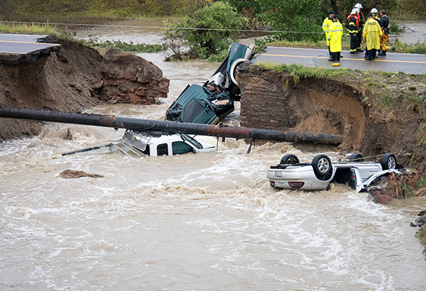
Photo courtesy of the U.S. Army Corps of Engineers
DRI: What inspired this study and how did the two of you come to work together?
Giovando: Well, a few years ago, we were working with Dr. Li Chen (previous DRI faculty) to examine how post-fire flood frequency may be changing. But from ERDC’s point of view, there were a few gaps that we wanted to address to make the analysis a little more complete. In our coordination and collaboration with DRI, we were hoping we could do a follow up effort to expand and address some of those gaps.
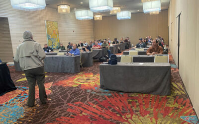
Yu: Right, and for more context, DRI and ERDC have a long-term program called the Urban Flood Demonstration Program (UFDP). So, every three to five years we organize a meeting and invite all of the Army Corps of Engineer Districts to talk about priority research directions. This study evolved from those discussions.
DRI: You write that this is the first time the concept of fire-continuum flood frequency analysis is introduced to the scientific literature. Why do you think it’s important to come up with new ways of examining the impact of repeated wildfires on flood risk?
Yu: Yeah, so this is the first study to use this more bottom-up, or process-based approach. I think the main contribution is that we try to study the physical processes of how wildfire effects flooding and how to incorporate that understanding into the flood frequency analysis. Most of the previous studies on this topic only focus on the statistics while ignoring the physical processes.
Giovando: I would add that, conceptually, when we talk about probabilities, they are based on an associated timeframe. That may be a probability of 1 in 100 or whatever it might be. The challenge is that when we talk about those probabilities, there’s an assumed stationarity associated with the data being used. And we know that the Western landscape is not stationary, especially when it comes to wildfires and other things like beetle kill that affect our landscape. So, I think the idea is how do we create a process that can be used to calculate those probabilities but still incorporate the physics of our changing landscape?
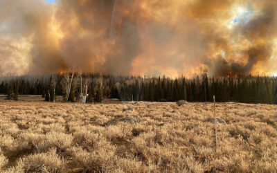
DRI: Zooming out a bit, how do wildfires contribute to flood risk and how do repeated events increase this risk?
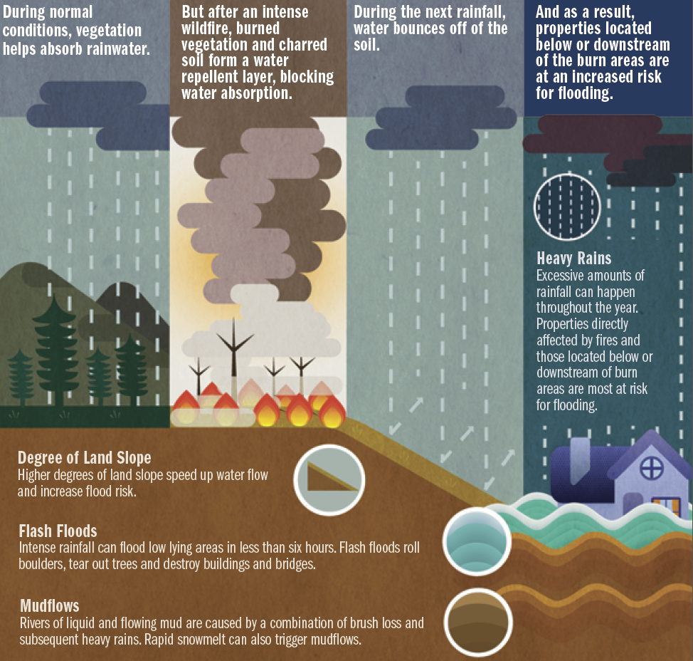
Giovando: Well, in burned areas, the vegetation that will intercept rainfall is reduced. So, more of it will make it to the soil surface. And once it gets to the ground, less of the water can penetrate the soil because of physical changes to the soil – it can essentially become water-repellent. This means that more surface water will make it into the stream channels. The other thing that happens is the roughness of the hillslopes can be reduced, because you don’t have vegetation, duff and other organic debris that you would typically have in forested areas, which means increased and faster runoff that concentrates more quickly in the streams.
So, given the same amount of precipitation, you’ll see increased streamflow. One of the challenges is that flow enhancement or increase varies both in space and time. The increase that we would see is going to be very situation and location specific, and that’s what makes studying this really challenging. We can get data for a particular river or stream, but we still don’t know how best to translate that to other areas. And that’s an active area of research.
DRI: Can you explain what you mean by flood frequency analysis framework in plain language?
Yu: Flood frequency analysis is a like a tool to estimate the relationship between the severity and the associated probability to occur. This kind of tool has been applied in a variety of fields, from flood management and flood insurance programs to flood mapping, etc. It’s not a specific software you have to use, but rather a conceptual idea of how you can grab the tool you are familiar with and feed it into our conceptual framework to use for your own watershed. So, I think this study gives people a conceptual idea.
Giovando: The underpinning of this concept is the flow frequency concept.
DRI: How does this new framework build on previous concepts?
Giovando: That’s an important point, because the flow frequency concept has been around for 100 years or more. Essentially, that’s how floodplain management is regulated, this idea of the 100-year flood or 500-year flood — it’s very ingrained into how local and state communities manage their floodplains. What I would say is that our framework has taken this concept that these processes aren’t stationary and tried to incorporate that so that we have a better recognition of what’s truly happening in the watersheds. Wildfire is certainly a substantial component of that non-stationarity, and climate’s the other component. What we want to do is at least provide a framework for communities that have wildfire in their watershed be able to estimate potential impacts and flood risk changes.
DRI: Can you talk a little more about the idea of non-stationarity?
Giovando: Flow frequency has an assumption that your data has similar statistics through time. In other words, the mean and variance of the streamflow data is not changing through time. Fundamentally, we know that’s not true. And it’s gotten to the point now where people can’t just assume that away or ignore it. Fire is a huge reason why we can’t just assume that’s true anymore.
Yu: I think you’re right. The conventional approach assumes there’s no change for the watershed condition, but we show that’s not true, especially for most Western watersheds, because of wildfire.
If you account for the warming climate and more wildfires, our framework can help to answer how the probability of large floods will be changing due to climate change.
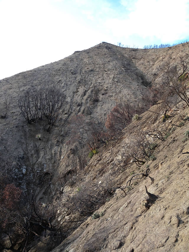
DRI: You use the upper Arroyo Seco watershed in Southern California as the case study. Why did you choose to apply the framework to this location in particular, and what did you learn?
Yu: We wanted to find a watershed where we could adequately and effectively test our idea. This watershed has really good data from long-term, continuous observations. That’s the simple reason.
I think we showed that wildfire impacts are occurring to a lot of watersheds in that region, and we do need to account for such impacts in the flood frequency analysis, as the federal guidelines suggest.
DRI: How can this new framework help emergency managers be better prepared?
Giovando: I think emergency managers will be able to better identify locations of potential risk for flooding, and whether there will be a change in the potential magnitude. I think this can help address not only immediate concerns, but also the long-term management of their floodplains.
Yu: I think our framework can help them to understand future hazards, to help them make proactive, rather than reactive, decisions.
DRI: Do you have planned next steps for this line of research?
Yu: Yeah, we do. Because this is a framework, it can always be improved by accounting for some missing parts that we didn’t account for in this study. One example is the connection between climate and vegetation recovery, or vegetation dynamics. In a dry year, it takes more time for the vegetation to recover following a wildfire, while recovery time is much quicker in wet years. So, it’s really dynamic. We haven’t accounted for that in this study and want to include it in the future. Jeremy has also been working on wildfire impacts on snow hydrology, which we didn’t include here because this watershed doesn’t have snowmelt floods. But other watersheds in the Western US experience snowmelt floods, and we want to understand how wildfire impacts both the snow hydrology and the eventual floods.
Giovando: I view this framework as kind of like the hub, and we can plug in different change conditions. Snowmelt in watersheds is one of those conditions where we can evaluate potentially how the flood risk changes following a wildfire. Another is looking at watersheds where perhaps you have a wildfire but also intensifying rainstorms and trying to understand how those two are going to magnify one another. I think there’s a lot of opportunity to use this framework in different ways to try to understand how risk will be changing based on what we’re seeing on the landscape today.
DRI: Is there anything else you think is important to mention?
Giovando: One thing that is always challenging is that the data we have available to us is often limited. Expanding outside of our case studies, where we have enough data, can certainly be challenging because we don’t have the same data resolution everywhere. And I think that’s certainly going to be a challenge as we move forward to try to translate this framework to other watersheds.
The full study is available from Water Resources Research at https://agupubs.onlinelibrary.wiley.com/doi/full/10.1029/2023WR035013