The report offers information about incorporating publicly available climate data into emergency planning and exercises
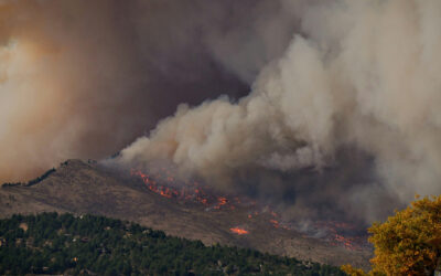
Reno, Nev. (September 4, 2024) – Climate change is fueling more severe storms and floods, droughts and fires, and communities around the world are grappling with how to prepare. Emergency managers regularly meet to examine possible disasters and discuss preparations and responses for protecting the public, but often default to using past disasters as examples. This fails to capture the extent of potential damage from future weather extremes, so DRI scientists partnered with the U.S. Geological Survey to produce a guidance document for incorporating publicly available data on historical and projected extreme weather events to aid with emergency planning exercises. The report, funded by the California Department of Water Resources, is available on DRI’s website.
Although many public agencies will find the report helpful, it is written with two groups in mind. The first, emergency management practitioners, will find information about data available for exercises that reflect the most current state of climate science projections and the increased risk they carry. The second part of the report is directed toward data developers, the people who build the scenarios used in emergency response exercises. The report offers techniques for building these scenarios and guidance for presenting the information in a useful form for emergency managers.
“Emergency response planners, critical infrastructure owners and operators, and natural resource managers in our region face impacts from increasingly frequent and severe atmospheric river (AR) storm events due to global warming,” says Maureen McCarthy, research professor of environmental science at DRI and a lead author of the report. “Damage from these extreme storms cost millions of dollars in response and long-duration recovery funding and put Tribal and underserved communities at particularly high risk. This primer provides a guide for emergency planners to develop scenarios that can test their ability to anticipate, respond, and recover from these events and to inform actions for strengthening community resilience in the future.”
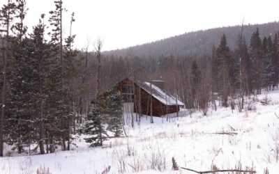
The report focuses on the use of climate data, including temperature, precipitation, and wind, to create computer simulations and maps that illustrate how the timing and locations of impacts may play out. These visualizations provide a foundation for discussing how emergency managers and others in the community might prepare or respond if the event were to happen in real life. This is particularly helpful for stretching planners’ understanding of how the impacts of a wildfire, flood, or drought may extend beyond the reach of past events.

“There’s been a lot of work into incorporating climate change into adaptation planning in California and Nevada, but this hasn’t been included in emergency management activities quite as much,” says Christine Albano, ecohydrologist at DRI and lead author of the report. “In many cases, emergency managers will use a historical storm for their exercise scenario and make it qualitatively more severe to address climate change, but we’re advocating for creating scenarios that are more quantitative so that maps, visuals, and data help people to conceptualize what might happen more vividly. We also propose methods for creating scenarios that represent our best knowledge of how storms or other hazards might be different from those we have seen before. The hope is that it spurs deeper conversations informed by data.”
The data and amount of work required for creating and visualizing different events will vary, Albano says, and the report also offers guidance on taking this into account. For example, a landslide or wildfire will require data that reflect the quickly evolving nature of the emergency, such as by the minute or hour, and over a relatively small area. However, planning for drought response would likely only require daily data but would affect a very large region. Understanding these differences helps emergency managers streamline their data needs and planning.

Albano and her co-authors used lessons learned from their work on past and current projects to inform the guidance. Water for the Seasons focused on drought scenarios for the Truckee River Basin, while the ARkStorm@SierraFront Project is a continuing effort to prepare California and Nevada communities for an extreme atmospheric river event. The original ARkStorm@Tahoe project included multiple workshops with over 300 emergency management professionals and community leaders from across the region. The research team shared maps and data about the ARkStorm scenario to gather information about how operations and their ability to safeguard communities would be affected. Those conversations then informed a tabletop emergency response exercise.
“Discussions with community members combined with the tabletop exercise provided insights about the effectiveness of federal, tribal, state, local and private sector emergency response plans to respond to an event of this scale and duration,” McCarthy says. “The diversity of perspectives is invaluable for identifying how to better prepare for future storms.”
Albano added that the report team started working on integrating climate change into emergency planning several years ago. “The data and tools now available for understanding and visualizing future risks and hazards is pretty incredible. The report offers an up-to-date list of these resources in the hope that they will be useful to emergency managers.”
– @driscience –
More information: The report, Incorporating Climate Data into Emergency Planning and Exercises – A Primer for Emergency Management Practitioners and Data Developers, can be found at: https://s3-us-west-2.amazonaws.com/webfiles.dri.edu/Projects/ARkStormTahoe2/Albanoetal2024_DRITechReport41303v2.pdf
Authors include: Christine Albano (DRI), Maureen McCarthy (DRI), Stephanie McAfee (USGS), Anne Wein (USGS), and Michael Dettinger (DRI)
About DRI
We are Nevada’s non-profit research institute, founded in 1959 to empower experts to focus on science that matters. We work with communities across the state — and the world — to address their most pressing scientific questions. We’re proud that our scientists continuously produce solutions that better human and environmental health.
Scientists at DRI are encouraged to follow their research interests across the traditional boundaries of scientific fields, collaborating across DRI and with scientists worldwide. All faculty support their own research through grants, bringing in nearly $5 to the Nevada economy for every $1 of state funds received. With more than 600 scientists, engineers, students, and staff across our Reno and Las Vegas campuses, we conducted more than $47 million in sponsored research focused on improving peoples’ lives in 2023 alone.
At DRI, science isn’t merely academic — it’s the key to future-proofing our communities and building a better world. For more information, please visit www.dri.edu.
Media Contact
Elyse DeFranco
Science Writer, DRI
Elyse.defranco@dri.edu