Reno, NV (Thursday, December 7, 2017): Working with large environmental datasets is a complex and time-consuming endeavor, often requiring huge amounts of data storage, specialized high-performance computers and technical knowledge. Climate Engine (ClimateEngine.org), a new, free web-based application created by a team of scientists at the Desert Research Institute (DRI), University of Idaho, and Google is aiming to change all of that.
New research published and featured on the cover of the November issue of the Bulletin of the American Meteorological Society (BAMS) outlines how Climate Engine improves the accessibility of climate and weather data by allowing users to create on-demand maps or graphs of various earth observation datasets using a standard web browser. Datasets are stored and processed in the cloud on the Google Earth Engine platform, eliminating the need for users to download, store and process large data files on their computers.
Climate Engine provides access to a variety of geospatial datasets that track vegetation, snow and water across the planet, as well as climate datasets that track temperature, precipitation and winds.
One of the web application’s greatest strengths, according to Dr. Justin Huntington, co-principal investigator of the Climate Engine project and associate research professor of hydrology at DRI, lies in the application’s ability to quickly and easily pair satellite imagery with different climate variables.
“We can process field-scale Landsat satellite imagery like we’ve never been able to before,” Huntington said. “For example, we can look at over 30 years of vegetation changes in a certain area and then pair those changes with the same historical record of climate, all within one platform, in a matter of seconds.”
In the paper Climate Engine: Cloud Computing and Visualization of Climate and Remote Sensing Data for Advanced Natural Resource Monitoring and Process Understanding, the authors describe the development, design and potential uses for this tool. The paper highlights various case studies related to drought, wildfire and agriculture, which each provide examples of how Climate Engine can be used to generate on-demand maps and time-series analyses of different conditions and extreme events.
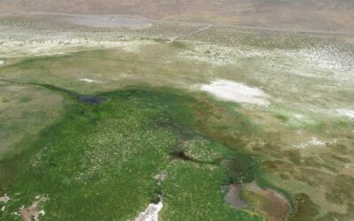
The authors outline the capability of this cutting-edge tool to analyze temperature change in the Arctic, evaluate vegetation stress during a historic drought in the Great Plains, map fire danger and burned acreage in Idaho, monitor groundwater-dependent ecosystems in Nevada, and support famine early-warning efforts in Ethiopia.
Because Climate Engine is free and requires no specialized software to use, Huntington and his colleagues hope that it will be useful to researchers and decision-makers around the world.
“Our work allows decision makers unprecedented access to analyzing big data related to environmental monitoring on their desktops and tablets without needing a supercomputer by using cloud computing resources provided by Google,” said John Abatzoglou, co-principle investigator of Climate Engine and associate professor of geography at the University of Idaho. “The ability to analyze such data in real time will help fill an information void and improve our ability to sustain our environmental resources including water.”
After using the web application to create a map or graph, results can be downloaded or shared in common file formats, saving users hours of time that was once spent downloading and processing large data archives.
“That’s the beauty of Climate Engine,” Huntington said. “Instead of downloading archives to get to the answer, you can just download the answer.”
Climate Engine was originally unveiled at the White House Water Summit in 2016. In the time since the product launched, the web application has been used by more than 8,000 unique visitors across the globe.
Recently, Climate Engine team members Huntington and Dr. Katherine Hegewisch of the University of Idaho presented a talk at the Famine Early Warning System (FEWS) science meeting in Washington D.C., and Hegewisch hosted a workshop for African FEWS field scientists.
Climate Engine will also be on display at the upcoming American Geophysical Union Annual Fall Meeting in New Orleans. The event is the largest and preeminent Earth and space science meeting in the world.
In the future, the Climate Engine team plans to continue adding new datasets such as sea surface temperature and European satellite data. They are also planning to add agency-specific spatial averaging domains, such as agency management boundaries and crop zones, and also hope to continue expanding their education and outreach efforts.
The idea behind Climate Engine, says Huntington, is to make large datasets available to researchers, decision-makers, journalists, farmers, or anyone else who might benefit from the information – and in an easy-to-use, approachable and simple format.
Climate Engine was primarily funded by Google and federal programs of the National Integrated Drought Information System, Famine Early Warning System Network, U.S. Geological Survey’s Landsat Science Team, and Bureau of Land Management’s Nevada State Office.
For more information and use the Climate Engine web application visit – ClimateEngine.org
###
The Desert Research Institute (DRI) is a recognized world leader in investigating the effects of natural and human-induced environmental change and advancing technologies aimed at assessing a changing planet. For more than 50 years DRI research faculty, students, and staff have applied scientific understanding to support the effective management of natural resources while meeting Nevada’s needs for economic diversification and science-based educational opportunities. With campuses in Reno and Las Vegas, DRI serves as the non-profit environmental research arm of the Nevada System of Higher Education. For more information, please visit www.dri.edu.
The University of Idaho, home of the Vandals, is Idaho’s land-grant, national research university. From its residential campus in Moscow, UI serves the state of Idaho through educational centers in Boise, Coeur d’Alene and Idaho Falls, a research and Extension center in Twin Falls, plus Extension offices in 42 counties. Home to more than 11,000 students statewide, UI is a leader in student-centered learning and excels at interdisciplinary research, service to businesses and communities, and in advancing diversity, citizenship and global outreach. UI competes in the Big Sky Conference and Sun Belt Conference. Learn more at www.uidaho.edu.


