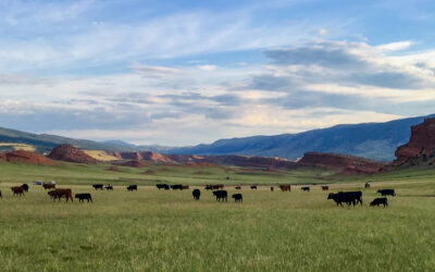
DRI’s Native Waters on Arid Lands project was recently featured in the 2024 World Drought Atlas, a 175-page hardcover reference book for decision-makers detailing drought impacts and adaptation solutions from around the world.
DRI’s Native Waters on Arid Lands project was recently featured in the 2024 World Drought Atlas, a 175-page hardcover reference book for decision-makers detailing drought impacts and adaptation solutions from around the world.
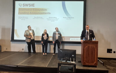
The investment will substantially strengthen the NSF Futures Engine in the Southwest, enhancing economic growth and job creation. WaterStart was created by DRI, with support from the Nevada Governor’s Office of Economic Development (GOED).

On March 27, DRI scientists gathered at the State Capitol to illuminate work that supports Nevada’s communities and landscape. With more than 600 scientists, engineers, students, and staff across our Reno and Las Vegas campuses, we conducted more than $52 million in sponsored research focused on improving peoples’ lives in 2024 alone.
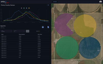
A NASA, DRI, and U.S. Geological Survey (USGS)-supported research and development team is making it easier for farmers and ranchers to manage their water resources. The team, called OpenET, created the Farm and Ranch Management Support (FARMS) tool, which puts timely, high-resolution water data directly in the hands of individuals and small farm operators.
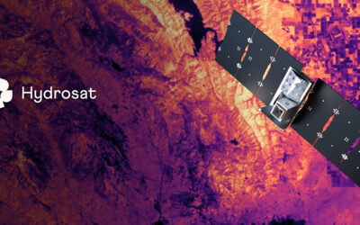
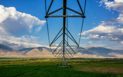
DRI is advancing water management in the Colorado River basin with support from the National Science Foundation’s Southwest Sustainability Innovation Engine (SWSIE) and the Governor’s Office of Economic Development. Partnering with Hydrosat, DRI uses high-resolution satellite thermal imaging to enhance evaporation estimates from key reservoirs, ensuring better resource planning amidst drought and population growth.
Relying on water storage won’t be enough to make up for declines in future water availability under a changing climate, new study shows. Beatrice Gordon, lead author of the study and sociohydrologist and postdoctoral researcher at DRI, says the research is needed to inform water management at the local level, where most decisions are made.
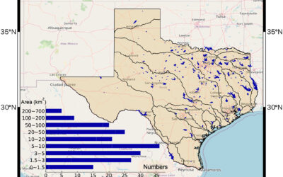
A recent collaboration between DRI and Texas A&M University researchers provides state of the art, real-time evaporation estimates for improved management of water supply reservoirs throughout Texas.
Climate Engine is partnering with the Bureau of Land Management (BLM) to guide drought planning on BLM-managed lands with support from NOAA’s National Integrated Drought Information System (NIDIS).
DRI’s Justin Huntington coauthored the new study, led by researchers at the University of Montana and the Montana Climate Office, which published mid-December in the Nature Journal, Communications Earth and Environment.