EVALUATING NATURE-BASED SOLUTIONS FOR COASTAL ADAPTATION IN SOUTHERN CALIFORNIA

CALIFORNIA NEVADA ADAPTATION PROGRAM 

Core Partners: The Beach Erosion Authority for Clean Oceans and Nourishment (BEACON) — a Joint Powers Agency in Ventura and Santa Barbara County, Climate Science Alliance and its Southern California Tribal Working Group, City of Imperial Beach, California Sea Grant.

Project Description: This project will coproduce and integrate climate, social science research, and Indigenous stewardship to support the advancement of effective and equitable sea-level rise adaptation planning with several collaborators across Southern California. The collaborators represent a diversity of geographic and coastal adaptation perspectives and information needs. BEACON, a Joint Powers Agency composed of local and regional coastal land use planners and resource managers in Santa Barbara and Ventura County, is interested in expanded regional coastal monitoring, social science data on use and economic value of the beaches, and down-scaled climate and sea-level rise information to inform future beach management strategies. The City of Imperial Beach, a historically marginalized community at the U.S.-Mexico border, is looking for improved projections for both episodic and chronic flooding events that can assist with developing adaptation pathways and strategies, including nature-based solutions. The Southern California Tribal Working Group (TWG), supported by the Climate Science Alliance has historically focused more on inland climate change resiliency, but this project opens the door for the TWG to identify opportunities for Indigenous engagement in coastal resource stewardship and resiliency planning. We will work with these partners on the three main components of the project described below (Figure 7).

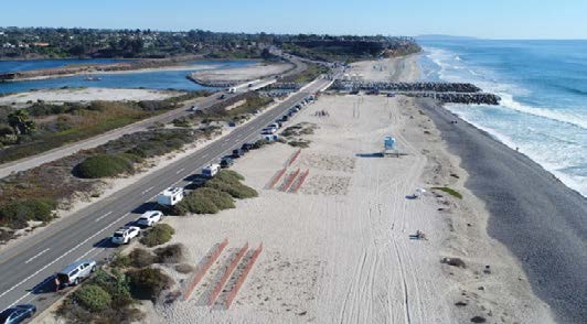
Coastal Adaptation Illustration

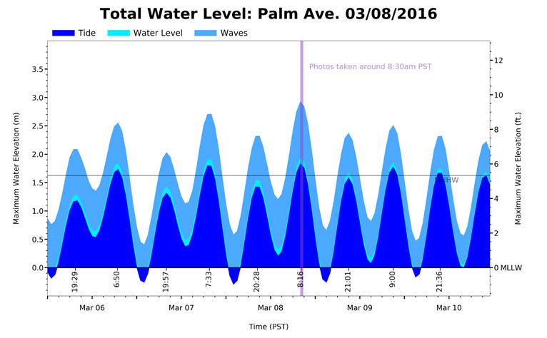
Updating physical and economic information to support coastal adaptation pathway planning: Coastal flood damages have not been tracked well in California, making comparative analyses of flood damage trends and evaluations of coastal adaptation strategies difficult. This component will focus on developing community knowledge about exposure and costs due to atmospheric river storms combined with tidal extremes and sea-level rise. This effort will leverage a new cohort of downscaled CMIP6 global climate models and evaluate coastal storminess factors for determining potential future water level extremes. This information will be translated into flood frequency and exposure summaries, tables, and visual tools and provided to local government partners in Imperial Beach and BEACON to support risk tolerance and adaptation pathway development. 

In addition to evaluating physical risk factors, a historic database of Southern California coastal storm events and associated economic impacts and emergency repairs will be developed with information gathered from FEMA, the National Flood Insurance Program, the California Office of Emergency Services, the California Coastal Commission’s emergency permit and armoring databases, and local sources such as the Santa Barbara Bucket Brigade — a community resource of flooding events and media coverage. The database will be used to co-develop recommendations for coastal flood damage and response monitoring metrics with Santa Barbara, Ventura, Imperial Beach and state government and resource managers. This data will be useful for tracking trends in fiscal impacts from storms and elevated water levels, identifying communities at risk and potential fiscal responses to inequities between communities, and for defining economic impact and adaptive maintenance thresholds important to establishing adaptation pathway tipping points and transition needs.

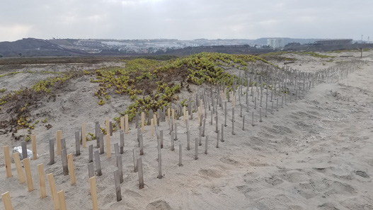
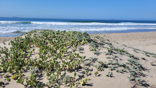
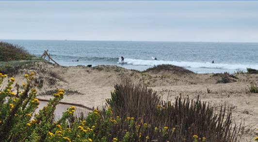
Evaluating the constraints and limitations of nature-based solutions: California’s first coastal dune NBS project was implemented at Surfer’s Point in Ventura, and this has led to other pilot NBS projects including Border Field dune enhancements in Imperial Beach and Carpinteria Beach in Santa Barbara County. This project element will provide a neglected societal perspective that is vital to the success of NBS approaches in the region. In collaboration with the designated project partners, NBS limitations will be evaluated and discussed in workshop settings. This will include assessments of current NBS demonstration projects and how policies, social perceptions, adaptive maintenance, and engineering/ecological design can determine their success. Specifically, this component will focus on expanding expertise in how much increased hazard exposure NBS and their functions can endure, even with enhancements and adaptive maintenance. It will also include an evaluation of NBS and socio-political adaptation drivers, including state and federal coastal adaptation policies, and local and regional plans for NBS and how these may constrain the expected lifespan and role of NBS within adaptation pathways. Interwoven into these analyses will be the perspectives and values gathered from the Tribal Working Group partners. The resulting analysis will assess NBS siting, suitability criteria and their potential role and lifespan to identify ways in which NBS may be used to support inclusive and holistic adaptation pathways. This will include case studies of how NBS can be implemented as short-term transition and long-term strategies and ideas for “tipping points” that would facilitate the transition of NBS approaches as sea-level rises. The results will be continually shared and explored with partners in Imperial Beach, Santa Barbara, and Ventura who are planning and experimenting with NBS to enhance their adaptive design and management, and performance expectations in response to sea-level rise. 

Integrating Indigenous stewardship in nature-based coastal adaptation strategies: This third component will be to establish and regularly convene a tribal-led workgroup to explore Indigenous perspectives and priorities around coastal stewardship in the face of climate change with a specific emphasis on coastal dunes and NBS approaches. The working group will be created and facilitated by the Southern California Tribal Working Group (TWG), supported by the Climate Science Alliance since 2016. The TWG is an established and respected tribally-led and directed group representing San Diego, Orange, and Riverside County tribal communities that serve to safeguard Southern California Indigenous natural resources and cultural connections from the threat of climate change. As part of this project, TWG members will explore inventories of planned and implemented NBS projects in Southern California collected by California Sea Grant to identify opportunities for elevating tribal priorities for coastal resource adaptation, access, and stewardship, and for integrating Indigenous values into the adaptation framework. The workgroup will also identify engagement and partnership opportunities for Indigenous partners to play leadership roles in advising and informing NBS planning and projects. Case studies involving Indigenous participants, values, and resource management will be coproduced with participants and disseminated and shared with other project partners, coastal managers, jurisdictions, and stakeholders. 

CLIMATE RISK AND ADAPTATION CHALLENGES

The Southern California coast, from Point Conception to the U.S.-Mexico border, is a heavily developed landscape modified over time to support large urban areas and economies that include agriculture, shipping, fishing, and coastal tourism (Kildow and Colgan, 2005). This landscape also includes some of the most heavily accessed beaches and coastline on the West Coast (King et al., 2016) which provide strong cultural connections for many populations, as well as a natural refuge for tourists, inland residents, and several threatened and endangered species. Communities from Imperial Beach on the U.S.-Mexico border to Santa Barbara are experiencing impacts to important beach amenities, roads, and cultural sites as these shorelines experience more frequent high tide flooding coupled with periodic heavy storm events.

In the next thirty years, it is almost certain that these coastal flooding and erosion hazards will become more severe and frequent as extreme storms and high tides are intensified by sea-level rise (Griggs et al., 2017). Understanding how these extreme conditions are expected to collide over the next few decades and accelerate with rising sea-levels is essential for helping Southern California coastal planners and decision-makers effectively plan short-term shoreline protection measures and adaptation pathways that adequately account for increasingly severe flooding and erosion risks. Several city and county planners are experimenting with Dynamic Adaptation Pathway Planning (DAPP), an approach defined as a sequence of adaptation actions or strategies over time which can allow for flexibility among policies, cope with uncertainty, and potentially spread the adaptation costs over time (Haasnoot et al., 2013). To implement this strategy effectively, they need to better understand and anticipate the time, costs, and conditions over which hazards threaten the natural shoreline’s ability to recover or when an adaptation strategy is likely to fail. Key points in this physical and decision time horizon is referred to as “tipping points” (Barnard et al., 2021). 

Advancing the coastal adaptation pathway approach also relies on expertise in how to leverage nature-based solutions (NBS), which involve restoring or emulating nature to increase human, ecosystem, and infrastructure resiliency to climate impacts. California policy strongly encourages NBS as alternatives to “hard” shoreline protection where feasible (California Coastal Commission, 2018). A challenge facing these same community partners is understanding the physical, social (economic, political and cultural), and ecological interdependencies that can limit the effectiveness of NBS features to withstand or adapt to more frequent hazards and rising sea levels as projected by updated California climate projections (e.g., Pierce et al., 2018). This was recently emphasized at a California Sea Grant Dune Resiliency workshop where Southern California coastal engineers, climate adaptation planners, and wildlife managers expressed interest in collaborating with researchers to explore how NBS can successfully contribute to adaptation pathway plans.

In addition, an important socio-cultural component for setting goals for coastal adaptation in Southern California is a recognition of the significant unmet need for inclusion of Southern California Indigenous peoples’ perspectives, knowledge, and stewardship roles in helping to decide the fate of coastal resources. Coastal Southern California tribes (federally recognized or not) were forcibly removed from their ancestral and traditional lands where their people once lived, traded, and harvested coastal resources. However, these Indigenous communities maintain their connections to coastal places and resources and are interested in leading and engaging in the dialogue for how these resources are managed, protected, and/or relocated as the climate changes. The goal of this project is to apply novel scientific approaches with communities to evaluate coastal adaptation approaches that include Indigenous perspectives. This project aligns with state efforts to conserve land and coastal waters using NBS and provides an opportunity to focus local investments and decision processes through an equity lens (State of California, 2020).

SCIENTIFIC AND SOCIETAL CONTRIBUTIONS: OUTPUTS AND OUTCOMES

The CNAP coastal project is focused on providing actionable knowledge and data at different scales and mobilizing scientific knowledge that can help define dynamic and adaptive schedules for adaptation action. A significant outcome of this project is direct experience and demonstration of how interdisciplinary knowledge can better support coastal communities to start making investments in adaptation actions, monitor flooding extremes and their socio-economic impacts, and build equitable and holistic natural and social resiliency for future sea-level rise accommodation and transition. Specifically, the proposed efforts will coproduce flood projections, including return intervals, and risk exposure information (e.g., easy-to-understand graphics, science syntheses and models) with local coastal planners and resource managers that are part of BEACON and at the City of Imperial Beach to directly inform their near-term sea-level rise adaptation pathway planning at a local and regional scale, improving community resiliency.

Another important intended outcome is the promotion of Indigenous engagement and leadership in NBS design, implementation, and co-stewardship. Including voices that have been historically excluded and integrating these into research that advances adaptation can begin to rectify historical constructs that largely have excluded Indigenous involvement in coastal resiliency and conservation efforts. Indigenous-focused products will contribute to these outcomes, as they are integrated into a better understanding of how to incorporate NBS into the various stages of adaptation pathways to support important cultural and natural ecosystem connections and resiliency. These unique perspectives on socio-cultural adaptation pathways and limitations will also be shared statewide to advance regional adaptation pathway planning and applications. The project will support building the capacity of local planners that can directly informal Local Coastal Plans which are required by California. In addition, we will engage with the regional Coastal Commission Offices and California Ocean Protection’s Council all which guide state coastal planning.

SOCIETAL BENEFITS

Economic and fiscal impact data and metric outputs will support adaptation pathway planning and monitoring, by providing enhanced capacity to track hazard exposure, calculate avoided costs due to adaptation strategies, prioritize communities at greater risk, and define fiscal adaptation thresholds (willingness to repair or maintain community assets and services when repeat damages occur). In addition to serving the identified partners, science integration and fiscal impact models for adaptation application will also be shared more broadly through state and national webinar and coastal adaptation training programs with support from California Sea Grant.  

EQUITY, DIVERSITY, AND INCLUSION

Inclusion of Indigenous communities and Hispanic communities in coastal adaptation planning is integrated throughout the project. The project supports Indigenous communities by eliciting their desired leadership role in coastal adaptation and identifying ways to mitigate inequities inherent in coastal adaptation and stewardship to date. Indigenous involvement and integration into the development of social and cultural considerations for NBS and coastal adaptation will help to advance more inclusive and holistic adaptation pathway planning within coastal communities of Southern California. The project supports Ventura and Imperial Beach, two coastal community regions that serve historically underrepresented Hispanic populations. The project will invest in Spanish translation of project materials and presentations, as well as targeted outreach to solicit Hispanic cultural experiences and connections to coastal resources. In addition, the project will seek to identify pathways to overcome barriers to use, stewardship and enjoyment of the coastal landscape by these communities as part of adaptation strategy development. 

MORE INFORMATION

Laura Engeman, Lead, SIO
lengeman@ucsd.edu